We provide comprehensive GIS solutions that integrate satellite, drone, and ground-based data into a unified, intelligent platform. Our system helps organizations visualize, analyze, and manage spatial information for applications such as forest encroachment surveys, UAV inspections, and real-time monitoring — delivering accuracy, flexibility, and operational insight across all environments.
Core Capabilities
-
Integrated Platform: Combines data from satellites, drones, and GNSS for real-time situational awareness and spatial intelligence.
-
Flexible Deployment: Available as Web and Mobile applications, supporting both online and offline operations in remote areas.
-
Cloud & Infrastructure Agnostic: Deployable on AWS, Google Cloud, Azure, or private cloud environments, ensuring security, scalability, and high performance.
-
Spatial Data Infrastructure (SDI): Provides secure, efficient data storage, access, and sharing for multi-user and multi-agency operations.
Advanced Features
-
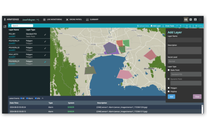
GIS Layer Management: Interactive tools for boundary monitoring, spatial planning, and area management.
-
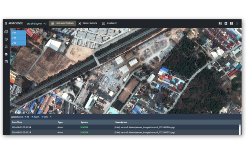
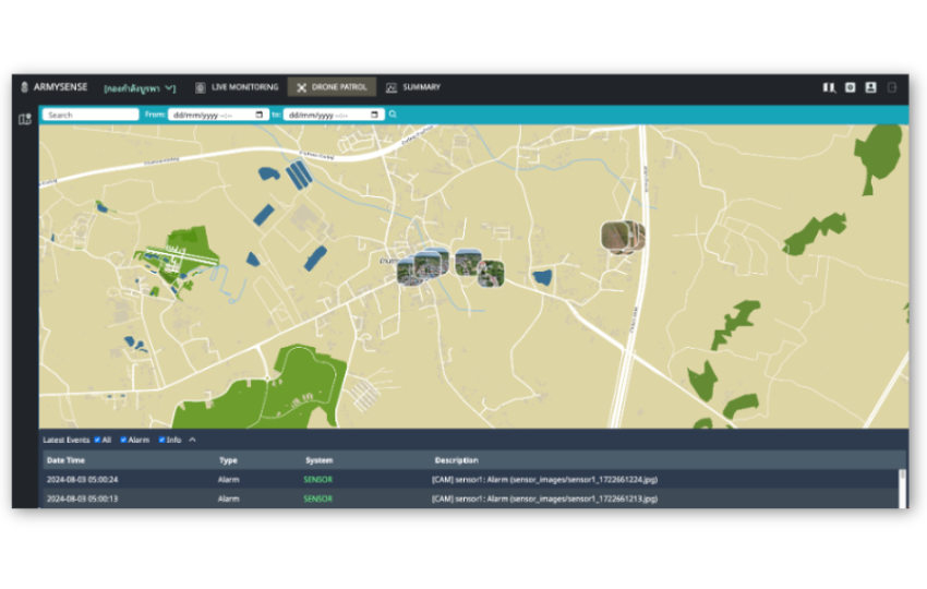
AI & Automation: Includes AI-powered surveillance for anomaly detection and automated alerts, plus drone patrol integration for rapid field inspection.
-
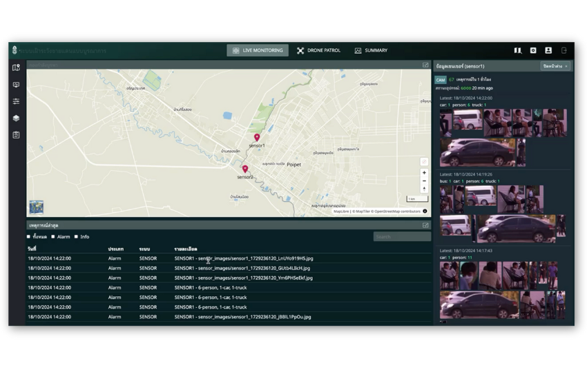
Real-Time Tracking: Seamless GNSS integration for precise positioning and live asset tracking.
-
Imagery Integration: Supports high-resolution satellite (30–50 cm) and drone imagery for detailed mapping and situational analysis.
-
Editing & Visualization Tools: Built-in GIS layer editing and interactive 3D visualization enhance analysis and decision-making.
Our GIS solution delivers an end-to-end spatial management ecosystem — adaptable to each client’s mission, scalable across cloud or on-premise environments, and designed to empower smarter decisions through technology-driven insight.
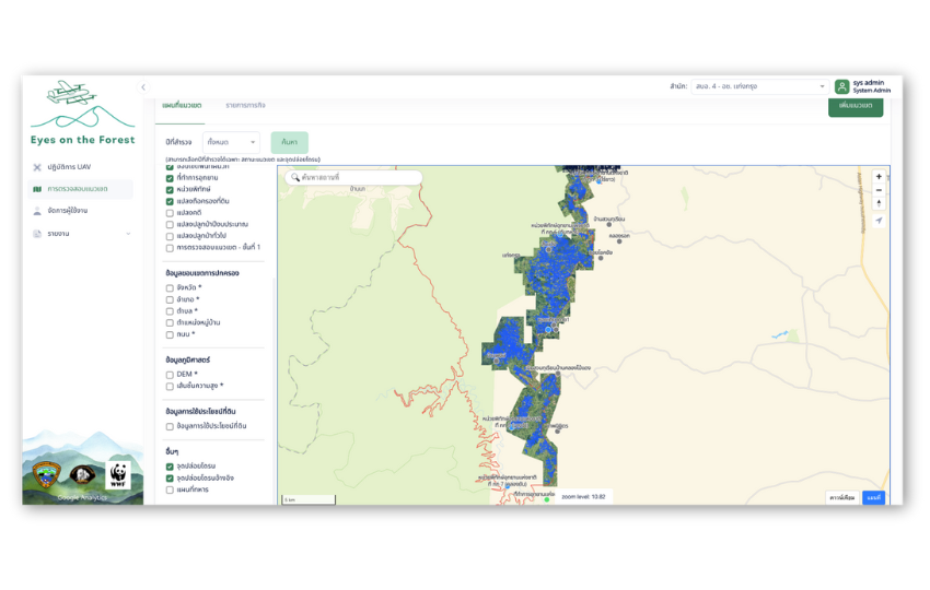
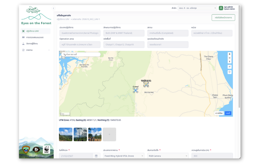
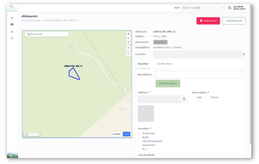
Forest Encroachment Boundary Inspection System
Product Highlights
Map Visualization: Interactive and detailed mapping support
Platform: Web app & Mobile app
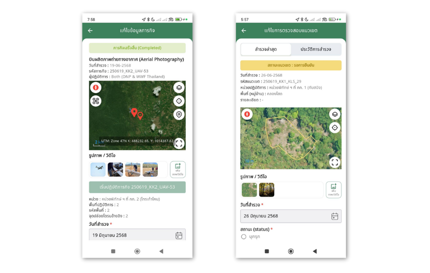
Purpose: Forest encroachment survey and UAV inspection
Key Feature: GIS layer integration for boundary monitoring and planning
Cloud Infrastructure: Built on AWS with high security
Offline Capability: Usable in areas without internet
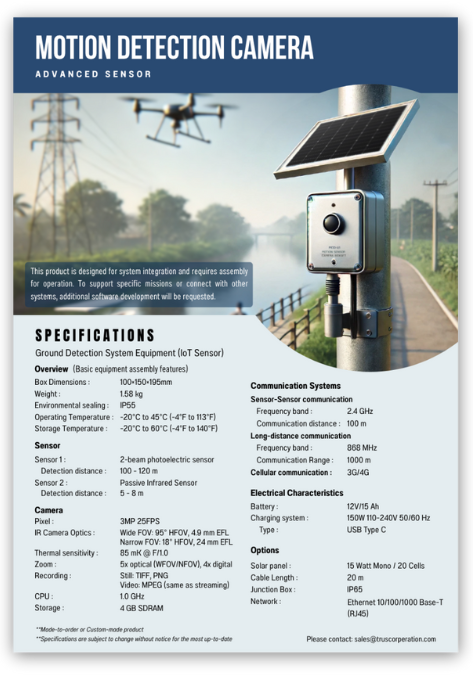
Intrusion Surveillance System
Product Highlights
AI-Powered Surveillance Network: Intelligent monitoring with anomaly detection.
Drone Patrol: Integrated drone operations for area inspection and rapid response.
GIS Editing Tools: Built-in GIS layer editing for area management and intrusion mapping.
Satellite Imagery Integration: High-resolution imagery support (30–50 cm) for enhanced situational awareness.